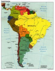
For those of you who are unaware of the existance of the Inca Trail, just a quick summary (and for those who do a refresher). At it's full extent the Inca Empire stretched from roughly Northern Ecuador to Santiago to Chile. Bordered on one side by the mighty Pacific Ocean and the other by the imposing Andes, the Incan empire was spread lengthwise down the continent. An extensive series of highways, along with stops for messagers and all the associated appartus of administering an empire, was the fastest way to get around. At its height, the Incan empire only lastest 100 years. From 1438 - 1532 the Incans were the dominate culture in this area of South America, until they were boldly and ruthlessly conquered by literally a hand full of Spanish conquistadores (an absolutely fascinating story - but more about that later). The fact that the Incan empire only latest for a century is a testament to the prodigious public works that the Incans built. The series of highways being one example, with numerous citadels and religious sites being another. These are often perched high in the mountains and were constructed out of solid stone with bare hands, no wheels, llamas, and definitely no dynamite. Incan architecture is amazing, especially the joins in big slabs of stone, which fit perfectly and look completely natural. Bear in mind too that they didn't have iron or steel tools.
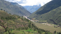
What is traditionally known as The Inca Trail is a stretch of trail running from near Ollantaytambo in the Urubamba Valley, and finishes at Macchu Picchu high in the mountains above the town of present day Aguas Calientes. The majority of the tourist trail follows the original Inca earth and stoneworks, including two llama width "paved" roads, and thousands of stone steps placed on hillsides. According to our guide Miguel, the proper trail should start just outside of Cuzco and run all the way to Macchu Picchu, but that would have added about another 15 days to the trek!
An 8am start to the day and a brief van trip to a place known as Km 82 marked the start of our Inca Trail trek. Not long after getting out of the van we were mugged by a whole lot of old ladies selling walking sticks for 3 soles (about NZ$1.30) - a bit expensive but they were to prove invaluable over the coming few days. The sticks were made of bamboo and had nicely woven handlke covers in traditional Quechua patterns. Just another quick history lession. People use Incas to refer to the people of the Incan Empire. However, this isn't quite correct. The Inca was the ruler of the people, and the common people were mostly Quechua and other cultures that the Incan Empire ruled - just like in the Roman or British Empires.
Once we had all bought sticks and negotiated our way through the old ladies we stopped to have our compulsory group photo at the Inca Trail sign. As you can see by the photo below there is a train track running in fron of us. This track runs to Aguas Calientes, and on the tracks people take the "Train of Shame" as we called it, to the town then take a bus up to the ruins. It was tempting at the start to just jump on the train and not have to trek 4 days! But I resisted and we shouted insults at the lazy people on the trains as they passed. Mostly fat Americans we assumed! You can also see the sticks we had in the photo.


After a walk along the train tracks and a quick rendition of "Stand By Me" (can anyone get the reference?) we arrived at the first of a number of checkpoints along the trail. A few years ago the Trail was a free for all, which inevitably caused heaps of problems with rubbish, overuse and crowding. So, the Peruvian government issued controls that only allowed 500 people to use the Trail each day. Contrast this with at times 2000 people using the Trail as I understand used to happen. As a result, we were allocated passes that allowed us to be on the trail for four days, including time at Maccu Picchu at the end.
After getting my passport checked I posed for the standard Englishman in the wilderness photo by the rope bridge crossing the Urumbamba River. As you can see below I had cultivated a fine beard to keep my face warm in the cold wilds of highest Peru!

Now is probably a good time to explain the magical qualities of coca leaves in the Inca Trail experience as at this point on the Trail our guide Miguel explained the role of coca in the Incan Empire. Coca was used extensively in the Incan Empire for religious and ceremonial reasons, among other functions. Primarily the royal and upper classes only had access to it, but as the Incan Empire and tradition broke down following the Conquest, the usage spread widely among the working and peasant classes. At its basic level it is the leaf of the plant that cocaine is made from. Whereas cocaine is made by refining the plant, coca leaves are simply just natural. The main benefit according to the locals and scientists is that it helps (somehow and I am not too sure of the processes) the body cope with altitude and give strength to carry out physical activity.
We left an offering of coca leaves on a rock just past the bridge, as a tribute to Pachamama, the Incan "Mother Earth". I am sure she appreciated it as the journey over the next few day was an amazing experience. Or maybe that was because of the coca leaves I used! Hahaha. Just to keep the worriers happy it's not hallucenigenic or a drug in the bad sense, or even illegal in Peru. What you do is wrap a few leaves up in a ball with a catalyst (using banana leaf ash) and place it under your tongue. There you leave it for about 20 minutes and then spit the stuff out. The theory goes that all the good stuff will dissolve into your body and give you an increase in energy. I was keen to test the theory over the coming days.
The morning we began the Trail it was overcast and a little rainy, which suited me just fine as it kept the sweating factor down to a minimum. Our porters head begun a we while before us, and up the road, but as they were carrying about 40 kgs each of our stuff it was not surprising we passed some of them on the way, but not for long! Mostly that was on the uphill legs, and even then we had these little dudes with these big backpacks (not like Macpac, but more like flour sacks with ropes around them) and wearing sandals fly past up on uphill legs. Downhill, they were always flying past us. Everyone has to have porters on the trail, and we had about 17 porters and cooks for the fifteen of us. We also had our guide, Miguel, and his assistant guide, Gato (well his real name was Enrique like our GAP guide but his nickname was Gato, which is cat in Espanol).
The porters would generally hoon off ahead and have our lunchsite or campsite all prepared and ready - even with individual bowls of warmed water to wash our hands and faces. Lunch on the first day was a three course meal, including dessert. So much for roughing it! They even set up a tent, with tables and chairs for us to sit out of the elements. From that you can get an idea of what they were carrying in total, plus our two man tents, 6kg of our personal gear allowance, their tents, food, and other equipment. Lunch was spent in a quiet valley with a small river through the middle, and looking up at the mountain in the background, I knew I was in Peru!

The sun eventually came out after lunch on the first day, but even with the overcast skies prior the sweat factor was rising on the back. That was probably the most uncomfortable thing for me throughout the whole trek, was the sweat that came pouring out of my body. Physically the Trail was fine, but I sweated more water out than I thought my body could even contain! Most of the walk on the first day was fairly straight forward, with a couple of calf burning uphill segments. Great for the physique. Along the way we passed by a few Incan ruins, the most notable being Llactapata in the valley below our first climb for the day.

On the way to our first campsite for the night we passed by a spot with a beautiful view of Mt Veronika, one of the major mountains in the vicintity that was one of two revered by the Inca. The campsite was further than the normal first day campsite as we were trying to get through the Trail in three days instead of four. Usually people do it in four days and on the fourth day race to the Sun Gate in the dark to see the sunrise over Macchu Picchu. However our guide said that each time he had done that this year (and he does it every week) it was cloudy and Macchu Picchu couldn't be seen. So we were working on the basis that we would get to Macchu Picchu on the afternoon of the third day, spend the afternoon there, sleep in Aguas Calientes, then come back up to Macchu Picchu again on the fourth day for more time at the ruin and our official guided tour of the citadel.

Campsite was reached at about 5pm as the clouds started to roll in. The location of our camp was at Yunkachimpa and had a beautiful view across the valley to an imposing mountain called Casamientuyoc. After changing out of sweaty clothes, washing the hands, face and upper body with warm water we had hot chocolate and biscuits. Dinner was a three course meal, with a dessert of chocolate pudding. After finishing my dessert everone else was full so I had another 6 or so chocolate puds. Yum. The campsite was at about 3300m above see level and the next day we were heading straight up to 4200m so I needed all the energy I could get. After checking out the beautiful stars following dinner it was time to hit the hay and rest up for our big day coming up.
 The ascent up to the Pass was fairly steep and consisted of quite a lot of steps as well as inclines. What made it worse was that the sun decided to shine brighter, and the sweating episode that occurred on the previous day was about a million times worse. But as tough as it sounded the ascent was a lot of fun, with great views, a few strategic stops, heaps of water taken in through the mouth, and promptly lost through the pores, as well as some singing when breath allowed. I can't believe that I voluntarily sung "Mambo No 5" but anything that took the mind off the climb was welcome. The body held up superbly and as the Pass came into sight the adrenalin started to kick in and the pace intensified. No big problems with the altitude, although I put that down to the coca leaves I was putting back at regular intervals.
 Just a quick note about Dead Woman's Pass. You can see from the photo below probably why it is called so. It's a dead woman lying down and this picture shows her breast, with the actual Pass just underneath her breast! The Pass is at 4.2 km above sea level and the view from the top is amazing. We managed to prove Miguel wrong by getting up there in 1 hour 40 minutes, and I was so pumped I even ran the last 40 metres or so. Simon and I were first up, closely followed by Sam, then Merryn and Mitzi. Actually we passed some of our porters on the way up, but I suppose they were carrying 40kgs worth of stuff!
 The view from the top was amazing. The first two photos below shows the view back down towards our first campsite, where you can make out tents. The third photo looks out across the valley on the other side of the Pass. The fourth shows Merryn, Simon, Mitzi, myself and Sam with well rested lungs.


 We rested for an hour before we headed off down the other side. A few others of our group had turned up at that stage, but as Miguel had said at the start of the day, just rest and then keep on going down the other side of the Pass until we reached our lunch spot. In continuing our power walking episode Simon and I charged down the other side of the Pass and reached our lunch stop at Paqaymayo, which for some groups is their second night stop. We arrived way before the porters had even started setting things up, so we gave them a brief helping hand then we sunbathed for a while waiting for the others and lunch. I also had to hang my singlet out as it was drenched in sweat. Yummy!


 Following another hearty lunch and self-applied sponge bath, it was back on the Trail and up towards the ruin of Runkuraqay and the high pass above it. The altitude differential was only about 400 metres from where we had lunch so the climb wasn't as tough as the one up Dead Woman's Pass. The clouds began to roll in and it cooled down so I welcomed the relief from the sweat. Runkuraqay was an interesting ruin. It is designed in the shape of a moon and the Inca and his queen(s) would stay there on their journeys to Macchu Picchu apparently. It also housed runners who were part of the Incan message chain that existed along the highways of the empire. The Pass was a little higher than the ruin, and going down the other side consisted of quite a steep downhill leg and stairs.